
Trace a Niagara Falls Street
A street search can establish a parcel owner, tax contact, recorded transfer party, mapped lot, or a historical directory association. It cannot by itself establish everyone who presently lives along that street. The most reliable street directory path begins with a known number, then follows the parcel rather than guessing from a surname. Keep the situs address, SBL, owner name, and date of every result together as the search moves between county systems.
- Enter the address or street fragment in PROS, then record the parcel’s SBL, situs, owner field, and mailing address.
- Search the SBL in the county GIS viewer to confirm the mapped parcel and inspect adjacent parcel geometry.
- Use the current owner and legal description to locate the acquisition deed, then work seller to earlier grantee for a prior transfer.
- Use New York’s voter route only for an individual with matching name, date of birth, county, and ZIP or address information.
- For a past year, check a reverse or criss-cross directory and preserve the printed abbreviations and cross streets.
That sequence separates ownership, geography, registration confirmation, and historical association. It also makes a weak match easier to spot.
Search Niagara Falls Streets in PROS
Niagara County PROS is the first official street directory tool because it combines address, owner, SBL, Street Finder, and municipality inputs with assessment information. Street Address uses contains-style matching. The portal says to omit suffixes, so a search such as “5 Pine” can return 5 Pine Street and related results. Street Finder is the practical way to browse the portal’s public-road dropdown, while municipality helps distinguish local context within the county.
| PROS field | Type | Street use |
|---|---|---|
| Street Address | Optional text | Contains search; omit street suffixes. |
| Tax Map # / SBL | Optional text | Exact bridge to GIS and Clerk research. |
| Owner Name | Optional text | Can return current or prior owner entries. |
| Street Finder | Optional dropdown | Browses the public road list. |
| Municipality | Optional dropdown | Narrows the county location. |
The Niagara County PROS Quick Search provides these controls without a stated online coverage date or result cap.
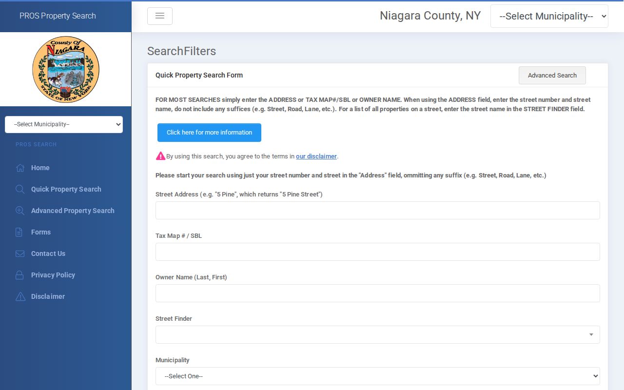
PROS is an assessment portal. Its parcel card can orient a street search, but it does not certify title or identify every occupant at the situs address.
Use Niagara Falls Street SBLs
An SBL is the tax-map parcel number. It is the most useful bridge between a written address, an assessment card, the county map, and a deed request. An address can change format, and an older deed may rely on a lot, block, subdivision, or other legal description instead. The SBL makes it less likely that a researcher will carry the wrong street result into the next system.
- Parcel
- A mapped unit of property used in assessment and tax records.
- Situs address
- The physical address assigned to the parcel.
- Plat
- A filed map that can show subdivision lots, blocks, and legal geometry.
- Criss-cross directory
- An address-keyed historical directory that can identify an occupant for a given year.
The mailing address on a parcel card is where tax correspondence is sent. It may belong to a trust, attorney, manager, family member, or another contact. A mailing address difference is a clue worth checking, not proof of who lives at the property.
Map a Niagara Falls Street Block
The county GIS viewer adds the physical part of a street directory search. It can search by owner, address, or SBL and puts possible matches in a dropdown. Its inspected tools include Measure, Layer, Draw, Bookmark, Add Data, and Select. Search a parcel, zoom to the street segment, select a nearby parcel, and take its SBL back to PROS. The map supports parcel navigation; it does not establish a relationship between people on nearby lots.
The Niagara County GIS viewer also includes a Public Notification Tool. It can buffer an area and export selected parcel ownership to CSV or PDF for public-notice work. That is a geographic and ownership function, not a household roster. Exact overlay names for every district or zone were not fully transcribed, so confirm the live layers before relying on one.
Follow Niagara Falls Deed Transfers
The deed chain begins with the current PROS owner and the property’s legal description or SBL. Look for that owner as grantee around the likely purchase period, then request or inspect the acquisition deed. Record the seller, recording date, instrument or Book/Page reference, and legal description. Search that seller as a grantee in an earlier period and repeat. When a street address fails, use the lot, block, subdivision, adjacent owner, or cross street to hold the trail together.
Niagara County directs online land-record searching to SearchIQS. The official materials reviewed do not state the online index cutoff, public search-field list, result cap, or free-image policy. Older books and maps may require a request or in-person work. The Clerk’s document/map request needs party names, recording date, and Book/Page or instrument number, and lists email, fax, and counter options with a response target of up to three business days.
The SearchIQS Niagara County login shows the account and subscription route.
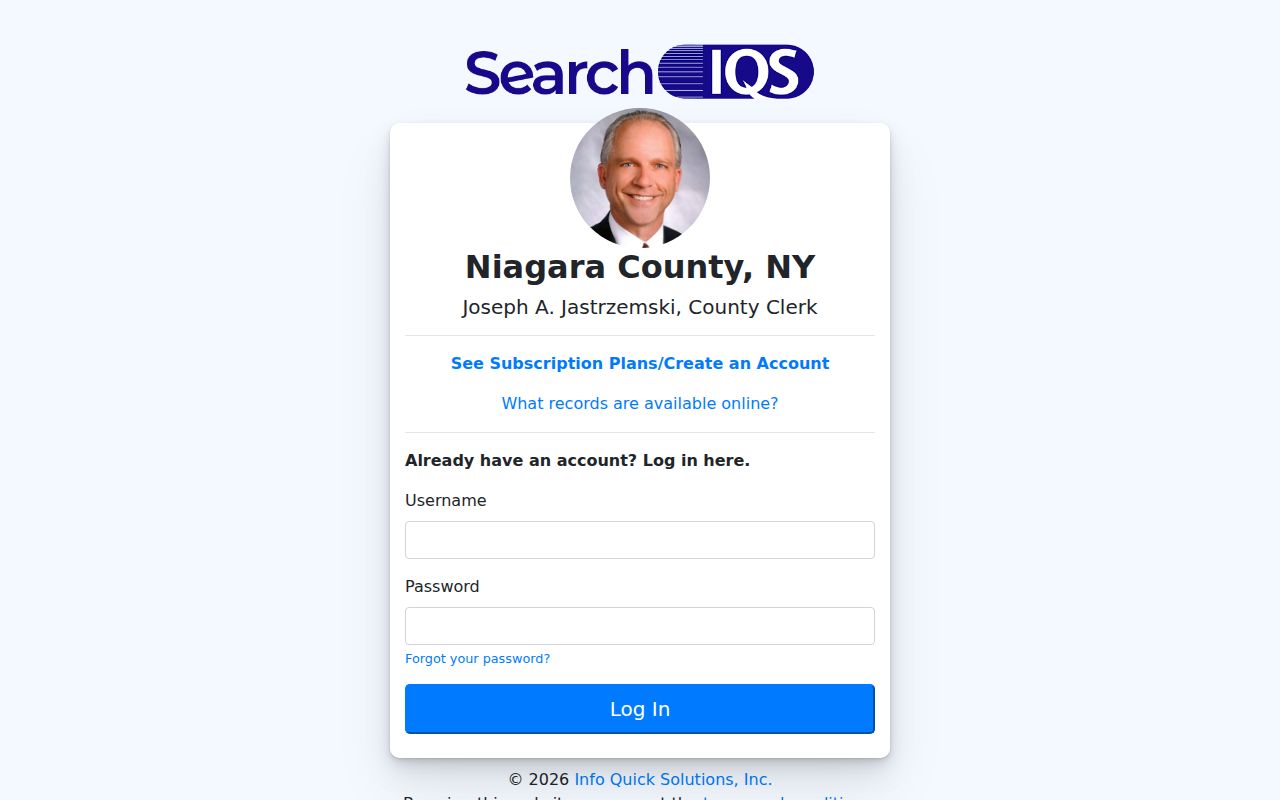
The login image is why the street directory does not claim a known online starting year for Niagara County deeds.
Niagara Falls Street Record Coverage
Address-keyed records answer different questions along the same street. The assessment roll identifies the county’s owner or tax-contact data. GIS shows parcel boundaries and adjacency. A recorded instrument identifies transfer parties and a legal description. A city request may produce a permit or code record when released. No row below should be read as a live household list.
| Address source | Keeper | What it can show | Access |
|---|---|---|---|
| Assessment parcel | County PROS/local assessor | Owner, mailing and situs addresses, value, property inventory | Free portal and office |
| GIS parcel map | Niagara County | Parcel geometry, adjacent parcels, map navigation, SBL | Public viewer |
| Deed, mortgage, lien | Niagara County Clerk | Parties, recorded date, legal description, document reference | SearchIQS, request, or counter |
| Subdivision plat | County Clerk/Real Property | Lot, block, and legal geometry | Map request or Clerk route |
| Permit or code record | Niagara Falls department | Site, applicant or owner field, work/request evidence if released | Request/status route |
Note: The city’s complete public permit or code-result index and its coverage date were not located in the reviewed official sources.
Niagara Falls Voter Route Limits
New York’s voter confirmation tool requires a person’s county, first and last name, date of birth, and ZIP or address information. It does not offer a street-wide browse function. A query for every voter on a street would misstate what the public form permits. The full voter file is a separate Board of Elections request under Election Law §3-103(5), and the requester must state an elections purpose.
Protected voter handling and New York’s Address Confidentiality Program can limit address display. That limit is deliberate. Use the individual New York voter lookup only for a matching person, and leave protected details outside a street directory search.
Niagara Falls Site-Address Requests
The City eGov Action Line accepts general, permit, code-violation, and animal requests keyed to a site address. Its form can include the site address, applicant name, mailing address, telephone, and owner information when different. A released permit or code file can therefore be an address lead, but it is not evidence that a person currently lives at the site.
The city route is request and status based. A complete searchable public permit archive, a standard result-field list, and a coverage start date were not found. For a specific document, name the address, date range, department, and record type. If the online status page does not disclose the underlying material, ask for the relevant department’s custodian or use the City’s FOIL process for non-exempt records.
Niagara Falls Streets in Old Directories
For a past household, a reverse or criss-cross directory is the street directory tool that makes the most sense. The Niagara Falls Public Library’s digitized collection covers 1886 through 1923, and its Vernon volumes extend later in cataloged runs. Entries may include an address, cross street, occupation, business line, or residence abbreviation. They show a relationship to a place in the volume’s year, not a current claim.
Printed shorthand matters. The 1886-87 sample uses h for residence, bds for boards or lodges, cor for corner, and n for north. Preserve those terms and search the volume key before converting an entry to a modern street label. The Niagara Falls directory book has the deeper collection detail.
Niagara Falls Street and ZIP Geography
A ZIP label does not define the city line or replace a parcel description. The official Niagara Falls map labels 14301, 14303, 14304, and 14305 inside the city and also shows nearby 14092, 14109, and 14132. It places familiar street anchors such as Main Street, Niagara Street, Pine Avenue, and Hyde Park Boulevard in a broader geography that includes the Town of Niagara, Town of Wheatfield, and the Canadian border.
USPS validation is the final check for a particular street number. The map does not label 14302, and the official materials reviewed did not establish its street geography or PO Box classification. A 2025 Postal Bulletin change involving 14302, 14303, 14305, and 14301 concerned container labels, not a universal street-address reassignment. Keep a ZIP as delivery information and keep the SBL as the parcel bridge.
Limits of a Niagara Falls Street Directory
A parcel owner may not be an occupant. A mailing address may lead to a tax contact rather than the property. A deed documents a transfer, not a household. An individual voter response requires matching inputs and is not a browsable street roll. DMV information, utility customer details, confidential addresses, restricted vital records, and sealed court files are outside the ordinary public street-search path.
When an address is absent, use the lawful custodian route or accept that the record is restricted. Do not treat a protected result as an invitation to seek private data elsewhere.